|
Venue: Mount Keen

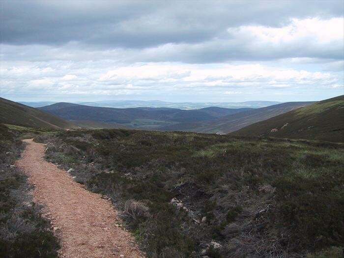
Random photos at: Mount Keen
| Latest photos at Mount Keen |
| Latest videos at Mount Keen |
| Venue Type: |

|
| No. of Trails: |
4 |
| Facilities: |

Car Park
|
|
|
Location:-
 Follow the B966 towards Edzel and then take the minor road out towards Tarfside
Click here to see a detailed map and information about any additional locations.
Description:-
Mount Keen is the most easterly Munro in Scotland with its summit at 939m. There are loads of walkers paths and rough fire roads around the hill, many of which are great fun on a mountain bike. But as ever, be careful about walkers and other users when storming down the hill. As you would expect due to the altitude, many of the higher paths are quite exposed, rocky and washed-out (great fun on the way down). You definitely get an ‘out in the wilderness’ feel on this hill (mainly because you kind’a are).
There are a couple of meeting point locations defined above, but the primary one is Tarfside.
|
|
|
Trails at Mount Keen
Summary

| Comments and ratings for Neep - Aboyne |
| Had to walk to the top of Keen, but the DH is worth it all :-) |
| pukindk gave this trail 5 stars about 6 years ago |
|
|
This is a great day out, with a bit of everything thrown in. The downhills off Mount Keen and down the Fungle are excellent high speed runs. Doing the route this way round ( anticlockwise ) means you ... read whole comment...
|
| wildhighlander gave this trail 5 stars about 6 years ago |
|
|
| 2wheelbarrow gave this trail 4 stars about 7 years ago |
|
Neep - Aboyne
Av. Trail Rating:
(3 votes so far) |
 |
Description:-
This is the standard route used by the 'Ecurie Neeps' MTB club.
A good summers day ride. Starting from Aboyne you have a leg warming spin along Glen Tanar, emerging from the trees half way bringing Mount Keen into sight. One of the two hard climbs of the day then takes you up to the saddle to the right of Mt. Keen, giving a fantastic descent to Queen Vic's well. Dropping out of the valley the route takes you onto the road for a fast spin to Tarfside and the second big climb. 60 mins later you reach the top of the climb at the Firmouth/Fungle junction! A fast & sandy off camber descent then rapidly drops you down to Birse Castle before skipping back up and over to the famous Fungle single track. All down hill from here to the Deeside road, Aboyne and a good pint.
|
| Photos for Neep - Tarfside |
| Videos for Neep - Tarfside |
| Comments and ratings for Neep - Tarfside |
|
| agnik1 gave this trail 5 stars about 7 years ago |
|
| Loved this ride. A real ‘out in the hills’ epic day out. Big climbs, big decents, and proper mountain trails. |
| wayne gave this trail 5 stars about 7 years ago |
|
Neep - Tarfside
Av. Trail Rating:
(2 votes so far) |
|
Description:-
This is an alternative route round Mount Keen sometimes used by the 'Ecurie Neeps' MTB club, which starts from Tarfside.
This route starts with an easy spin out the public road as far as Tag1. From there it’s rough doubletrack out past Queen’s Well at Tag2. Then it’s the first big climb of the day up to the side of Mount Keen itself on a fireroad. At Tag3 the trail changes to singletrack and after an initial climb flattens out into a very nice natural rocky trail bypassing the summit of the hill. At Tag4 you have a fantastic rocky singletrack decent for a few hundred meters. Some large boulders and non-obvious line choices make this a very interesting natural decent. From Tag5 the trail becomes firetrack, but a rough rocky surface and good gradient make this as fast a decent as you want to make it. Over the bridge at Tag6 and after a quick bit of XC, its up the second big climb of the day. The surface is quite washed-out and rocky, but all cyclable if you have the energy. From Tag 7 you have a huge long decent down the side of Clachan Yell. This decent is on firetrack most of the way, but it’s so rough and washed-out that it makes for a fantastic fast rocky ride all the way down, with loads of little natural jumps and little obstacles if you want to use them. The great thing about this decent is that it just seems to go on and on! After crossing the bridge at Tag8 you have a gentle spin along the side of the river before the start of the third big climb of the day at Tag9. Initially in the forest this fireroad climb just keeps on going, up and up, and just when you think you got to the top you get a little bit of down and then need to start going up again. After a few ups and downs and a bit of a boggy section, you get to the start of the decent back down into Tarfside at Tag10. This decent is all fireroad and starts out quite rocky and interesting. It then joins the Fungle road and due to some recent resurfacing work becomes a bit boring. You loose a lot of altitude so there’s plenty of opportunity for speed, but it just seems such a shame to loose it all on such a tame surface. Turn left at Tag11 to have the last section of the Trail go through a nice interesting rough grassy decent back down to Tarfside.
|
| Photos for Mount Keen - almost |
There are no photos against this trail yet Add photos
| Videos for Mount Keen - almost |
| Comments and ratings for Mount Keen - almost |
Mount Keen - almost
Av. Trail Rating:
(0 votes so far) |
 |
Description:-
From Ballater, take the route, following the signs to Mout Keen. Up to the ponds is fire road, so just a good grind. From the ponds, again signs to Mount Keen, about 1-2km of fire road then it turns off on to a track that is meant to be ridable, but being a bit boggy and drainage ditches every 30m or so make it a bit stop - start. Once over the top at the iron gate, a nice track down to the main Mount Keen fire road from Aboyne is challenging in places. The plan was to attempt Mount Keen and decend back to the bridge, but once the fire track runs out the track is a bit boulderish and ascent on two wheels is beyond my skill level, so about turn and and a hack down the track towards Aboyne, turning off to go over Balck Craig back to the SDR. Look out for the track on the river side of the road back to Ballater, at bit fire road, at bit single track, but better than the SDR any day.
|
| Photos for Mount Keen Summit |
There are no photos against this trail yet Add photos
| Videos for Mount Keen Summit |
| Comments and ratings for Mount Keen Summit |
Mount Keen Summit
Av. Trail Rating:
(0 votes so far) |
|
Description:-
This route starts at the Glen Esk side and heads straight up to the summit and back down the same track.
Start from the Auchronie car park straight onto the rough 4x4 tracks along the river side. The first 2.5 miles of the track is fairly level, carry on past the Queen's Well and across the small burn. From point 1 the path starts to get slightly rough and gradually builds in elevation, continue up through the back to back hairpins as the path climbs steeply. At point 2 there is a split in the path, the left track goes around the summit, take the right path straight up to the summit. The path is narrower and has large stone drainage channels (slow going up, fun coming down) As you near the summit at point 3 the path turns in to a boulder field, you will more than likely need to carry your bike up the last 15 to 20m.
You've made it your at the summit! now for the descent, follow the path as you came up and enjoy the spectacular views of Glen Esk, it's a quick run down straight back tot he car park.
|
|
|
|
|
Overall comments about Mount Keen
|
|
|
|
BBC weather forecast for
Mount Keen
|
|
|
|
Links to external sites related to Mount Keen
-
- Wikipedia Entry for Mount Keen
-
|
|
|
|
Terms of Use
 Mountain biking is a dangerous sport. Information presented here solely reflects the personal opinions of the site’s users and must NOT be relied upon for any decisions you make which might affect your safety. Mountain biking is a dangerous sport. Information presented here solely reflects the personal opinions of the site’s users and must NOT be relied upon for any decisions you make which might affect your safety.
By viewing this page you agree to the site’s Terms of Use (Click here for more details).
|
|
|